
Fall Hikes in Asheville Area

Big Butt Trail A high-elevation hike through a northern hardwoods forest
GPS Coordinates N35.7044807, W82.3728216
Difficulty: Difficult
Length: 4.8 miles round-trip
Region: Pisgah National Forest/Blue Ridge Parkway
Duration of hike: About 4 hours
Elevation gain: 1300 Feet
Type: Out & Back
Facilities & Parking: Paved parking area
What to Expect
Two trails start at Walker Knob Overlook. The Mountains-to-Sea Trail with its characteristic white circles starts from the middle of the parking area. This hike on the Big Butt Trail goes up from the left side, in back of a wooden sign which says “Little Butt 3 miles,” a slight overestimation. Little Butt is our destination; Big Butt, itself, is overgrown and without a view.
LEAVE NO TRACE TIP
Big Butt Trail is less traveled than other nearby trails, meaning many people hike this trail looking for peace and solitude. Respect your fellow hikers by keeping noise to a minimum. And, on narrow parts of the trail, step to the side to allow an uphill hiker to easily pass.
The trail descends through a fir spruce forest, going north, and perpendicular to the Blue Ridge Parkway. But soon you’re off Parkway land and into Pisgah National Forest. The trail skirts private land on your right, owned by the Cane River Hunt Club. After 0.2 mile, the trail goes up. There is no mistaking the boundary, with its many private property signs and red paint.
At 0.5 mile, you’ll reach the top of a knob for obstructed views to your right. The trail now descends steeply. When the trail dawdles gently back up, you’ll get your first views of the Black Mountains. The trail zigzags down walking between two humps where both Little and Big Butts are now obvious. At 2.1 miles, reach a gap and start climbing steeply to go around several boulders supporting beech trees roots growing out of them.
At 2.4 miles, a short path to the right leads to Little Butt—a wide rock outcropping, perfect for a snack break. Looking across the Cane River, the outstanding eastern views reveal the whole Black Mountain range. Starting on your right, the mountain with the transmission tower is Clingmans Peak. Mt. Mitchell, the highest peak, is in the middle. Continuing left, Mt. Craig and Big Tom are the next two mountains. Return the same way.
Directions
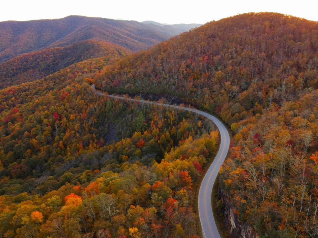
Take College St to NC 694N/Town Mountain Rd. After 6.3 miles, turn left onto the Blue Ridge Parkway. About 17.5 miles later, Big Butt Trail starts at Walker Knob Overlook on the Blue Ridge Parkway, MP 359.8.
Douglas Falls Hike An off-the-beaten path gem
GPS Coordinates 35.728815, -82.374353
Tucked away in the beautiful Big Ivy area of Pisgah National Forest, the 70-foot Douglas Falls offers the rare opportunity to walk behind a waterfall. The waterfall drops from an overhanging cliff and features an impressive rock wall in the background.
Douglas Falls is generally a low flow waterfall (unless after a big rain) but it’s a great setting to enjoy the beauty of the forest. It is said that the waterfall was named after Supreme Court Justice William O. Douglas, who was appointed to the court by Franklin D. Roosevelt and was an active environmentalist.
What to Expect
You can access the falls from the Craggy Gardens Visitor Center on the Blue Ridge Parkway at Milepost 364.6. This is a 6.6-mile strenuous hike on a rugged trail that is only recommended for experienced hikers. Note: The shorter access trail from Forest Service 74 near Barnardsville is no longer open.
LEAVE NO TRACE TIP
The remote Big Ivy area, home to Douglas Falls, is known for its wild beauty. Help keep Big Ivy beautiful by packing out your trash.
Directions
To access the Douglas Falls Trail (also known as the Carter Creek Falls Trails) from the Craggy Gardens Visitor Center, follow the Mountains-to-Sea Trail (MTS) south for 1 mile to the intersection with the Falls Trail. From here, it’s another 3 miles past several other cascades. There are maps available at the Visitor’s Center.
Know Before You Go
If you do choose to walk behind the waterfall, exercise extreme caution as the rocks may be more slippery than they appear.
GPS Coordinates
35.728815, -82.374353
Laurel River Trail Once a rail bed, now an idyllic hike along a mountain creek
GPS Coordinates N35.912774, W82.756868
There’s something about the Laurel River Trail that feels hidden and undiscovered, even if you’re sharing this former rail-bed trail with others. Take a picnic, bring your dog and wear your swimsuit if it’s summer. There are many places to sit out on the rocks and soak in the sun. This is a family-friendly hike that even small children can handle. Combine it with a visit to Hot Springs just 10 minutes farther away for a full-day outing.
What To Expect
The parking lot is along the side of the road and fills up on nice days, so consider getting an early start or waiting until later in the afternoon. Take the trail down through the woods, passing an abandoned rail car on the left (it’s private property, so keep away). Big Laurel Creek will be on your right (despite the name ‘river’ in the trail’s title). The trail bears to the right, passing a private home. Once you round the bend, you’ll start to see a few flat rocks in the river that you can wade out to. While the water’s not very deep anywhere along the trail, it’s deep enough for a dunk in several places. The sides of the trail are shady, so you’ll also find some good picnic spots here.
While the trail continues for 3.6 miles, it enters Pisgah National Forest at the 1-mile mark. For families with small children, this can be a good place to turn around. If you continue, you might see the remains of the old logging town of Runion, once serviced by the railroad that came through here. When you get to the end of the trail, you’ll actually encounter an active railway.
Hot Springs is a great add-on trip from here: only about 10 minutes away, there are pubs, restaurants, shops and of course the famed hot springs.
LEAVE NO TRACE TIP
Wildlife make their home under the rocks along the river. Preserve their habitat by leaving rocks where they are. Removing rocks to build a cairn (for example), may prove fatal for the sensitive wildlife who call these spaces home.
Directions
From downtown Asheville, take US 19 N/U.S. 23 N/U.S. 70 W/I- 26 toward Weaverville/Woodfin. Continue onto I-26 W/US-19 N/US-23 N/US-70 W for 8 miles. Take exit 19A and merge onto US-25 N/US-70 W toward Marshall. Stay on this road for 21.3 miles until the just before the intersection with Hwy 208. The parking lot is gravel and will be on the left.
Roan Mountain Hike on the Appalachian Trail unforgettable section of the AT GPS Coordinates 36.106386, -82.110335
Considered one of the most scenic areas on the entire Appalachian Trail, this section starting from Carver’s Gap (elevation 5,512) takes you across three spectacular unique grassy hilltops (known as “balds”) with unimpeded views.
If you arrive in mid-to-late June, you’ll catch the rhododendron bloom, one of Western North Carolina’s most anticipated seasonal events, along with the bloom of the rare, endangered Gray’s Lily.
What to Expect
For the three-bald hike, you’ll access the Appalachian Trail from the Carver’s Gap parking area which sits at the North Carolina / Tennessee state line. Carver’s Gap is marked with a giant National Forest sign. From the sign, cross the main road and enter through an opening in the wooden fence. Photo credit: @adamgravett
Follow the trail uphill into the forest. After a brief stretch in the forest, you’ll quickly emerge out onto the open meadows of the Roan Highlands.
Just three-quarters of a mile from the trailhead, you’ll reach the first bald: Round Bald (marked with a sign). Turn around here for a 1.5-mile roundtrip hike or continue onto Jane Bald.
To reach Jane Bald, stay on the Appalachian Trail and head downhill and then back up to the rocky bald (marked with a sign). You can turn around here for a 3-mile roundtrip hike.
Last up is Grassy Ridge Bald. After leaving Jane Bald, you’ll eventually come to a fork in the trail. To the left, the Appalachian Trail heads downhill to the Overmountain Trail Shelter. For this hike, don’t make that turn. Continue straight ahead to make the uphill climb (much of it through a tunnel of rhododendrons) to Grassy Ridge.
Once there, you’ll see a large stone with a plaque dedicated to Cornelious Rex Peake. Take some time to enjoy the expansive Grassy Ridge Bald. It’s a great place for a picnic. Then, retrace your steps to Carver’s Gap to complete your 5-mile loop hike.
LEAVE NO TRACE TIP
Roan Mountain features a collection of rare plant life, including some of the most beautiful wildflowers in the Blue Ridge Mountains. Leave what you find so blooms are there for others enjoy.
Other Hiking Options at Roan
In the opposite direction of the balds, you can hike from Carver’s Gap on the Appalachian Trail south/west to Roan High Knob (there are limited views on this hike). The terrain on this part of the trail is quite a bit different from the balds because it’s shady evergreen forest. After 1.5 miles of hiking, you’ll come to the intersection with the Roan High Knob Shelter — the highest elevation shelter on the Appalachian Trail (6,285 feet). Take this trail up to the summit and the view point behind the wooden shelter. The total hike is about 4.5 miles roundtrip.
Another option is to do a 2.4-mile roundtrip hike to the stunning Roan High Bluff overlook via the Cloudland Trail. Drive up the road from Carver’s Gap to the Roan Mountain Recreation Area and park near the Old Cloudland Hotel. Please note that you’ll pay a $3 to $5 access fee to enter this recreation area depending on the time of year. Begin the Cloudland Trail at the end of the parking area. You can also drive out farther to the end of the loop and catch the Cloudland Trail for just a 1-mile roundtrip hike each way.
While in the area, you can also choose to visit Roan Mountain State Park, which is located in Tennessee eight miles from Carver’s Gap. Roan Mountain State Park features 12 miles of trails, plus a seasonal pool, historic farmstead and camping areas.
Know Before You Go
The temperature is often dramatically cooler here than in Asheville (it can be a 20 degree difference or more!), so dressing in (or bringing) layers is the way to go. It can also get very windy on top of the balds.
Directions
Take I-26 West to Exit 9, Burnsville Spruce Pine. Take 19-E 18 miles to Burnsville. Once you go through Burnsville, take 197 N to Red Hill (about 11 miles). At the intersection of NC 226, go south to Bakersville. In about 5 miles, you’ll reach Bakersville. Turn left onto NC 261 North. Stay on this road for 12.8 miles until you see the sign for Carver’s Gap. To get to Roan Mountain State Park in Tennessee, continue up the road you arrived on (NC 261 becomes Tennessee 143) for eight miles.
Hiking Craggy Gardens Blue Ridge Heaven Just Miles From Town
Just a short drive from downtown and I’ll be at Craggy Gardens (Craggy for short) and a soaring 5,892 foot elevation. This is the locals’ favorite spot to head for the hills and get in a quick hike and huge dose of Blue Ridge beauty.
The Blue Ridge Parkway Visitor Center
Worthy of a stop along the way is at the Blue Ridge Parkway Visitor Center at Milepost (MP) 384 (a mile south of US 70 intersection), about eight miles east of downtown Asheville. This is where we start our day and the place to begin any journey along the 469-mile stretch of the Parkway.
Folk Arts Center
Just two miles north of the Visitor Center is the Folk Arts Center offering the finest examples of Southern Appalachian craft on exhibit and for sale. The day we were there we were able to see some of the master crafters at work. Check out the events page, maybe you’ll be lucky enough to hear some traditional mountain music.
Exploring “Craggyâ€
I love Craggy because every season offers a different landscape of color. An amazing time to visit is in mid-June when there are endless pink and purple blooms of native Catawba rhododendron. This is home to rare and endangered plants and a NC Natural Heritage Area.
On this trip we skipped The Craggy Gardens Trail, which can be accessed from the south end of the Craggy Garden Visitor Center (open May – Oct.) parking area (MP 364.5) or from the north end of the picnic area (MP 367.6). From the parking area, it is a moderate uphill climb for 0.3 mile that ends at a trail shelter with amazing views. Spread out your blanket because this is picnic paradise.
Instead we opted for the Craggy Pinnacle trail. A short hike with big rewards, we embarked at the Pinnacle trailhead that begins at the upper level of Craggy Dome at MP 364.1 My friend Dane (not a big hiker) joins me and a backpack full of locally grown treats from the tailgate market downtown. It will be about 20 minutes before we reach the top and indulge in both lunch and the views. The (1.4-miles round-trip) trail winds through a canopy of rhododendron, ancient-looking sweet birch and tall rock croppings (kids love them), finally reaching the 5,892-foot summit at Craggy Pinnacle. The 360-degree views will take your breath away – make sure you plan on taking time to linger.
What To Know Before You Go
- Bring a jacket, plenty of liquids, food, comfortable shoes and a full tank of gas.
- Craggy Gardens often gets lost in cloud coverage but it can clear in minutes – be patient.
- Check the Parkway for road closures due to weather or construction.
- Print a map of Craggy Gardens.